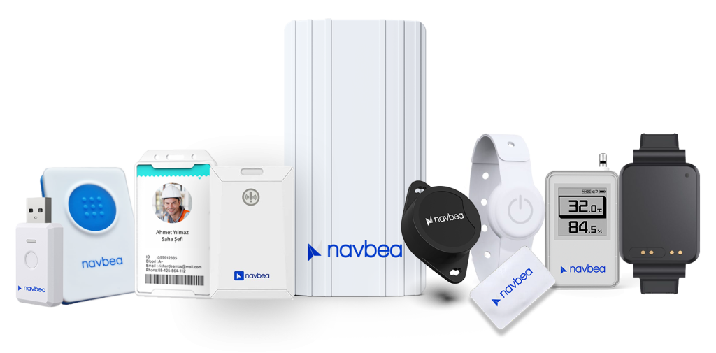
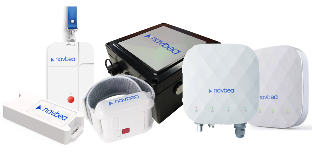
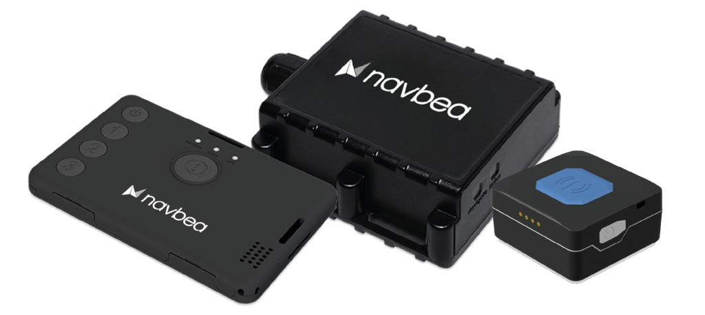
Navbea, Gerçek Zamanlı Konum Sistemi (RTLS) teknolojilerine hibrit bir yaklaşım sunarak karmaşık güvenlik ve operasyonel senaryolar için esnek çözümler sağlar. Navbea’nın güçlü yazılım altyapısı, Bluetooth Düşük Enerji (BLE), RFID, UWB, GPS ve Yapay Zeka destekli kameralar gibi çeşitli teknolojileri entegre ederek tesisler ve geniş alanlar için güvenilir ve kapsamlı bir takip çözümü sunar. Bu makalede, Navbea RTLS sistemlerinde kullanılan temel teknolojilere ve bu teknolojilerin faydalarına ve sektör uygulamalarına odaklanacağız.
Bluetooth Düşük Enerji (BLE)
Bluetooth Düşük Enerji (BLE), özellikle iç mekan konum takibi için optimize edilmiş düşük enerjili veri iletim protokolüdür. BLE’nin başlıca avantajları, düşük maliyet, düşük enerji tüketimi ve kurulum kolaylığıdır. Bu da BLE’yi personel ve ekipman takibi gibi uzun vadeli kullanım gerektiren uygulamalar için ideal hale getirir. BLE cihazları, büyük alanlarda takip yapmayı sağlayan konum ve hareket verilerini periyodik olarak gönderir.
BLE’nin Teknik Özellikleri
- Düşük Enerji Tüketimi: BLE teknolojisi, batarya ömrünü korumak için son derece avantajlıdır. BLE cihazları, standart Bluetooth’tan daha az enerji tüketir ve bu da sensörlerin uzun süreli çalışmasına olanak tanır.
- Menzil: BLE cihazları, açık alanlarda yaklaşık 100 metreye kadar etkili bir menzil sunar. Kapalı alanlarda duvarlar ve diğer engeller sinyal menzilini azaltabilir, ancak BLE çoğu tesis ortamında yeterli performans sağlar.
- Verimli Veri İletimi: BLE cihazları, düzenli aralıklarla enerji tasarrufu sağlayacak şekilde sinyaller gönderir. Bu sinyaller, konum (RSSI değeri) ve cihaz durumu gibi veriler içerir.
- 2.4 GHz Bant Genişliği: BLE, WiFi ve diğer kablosuz cihazlarla uyumlu olan 2.4 GHz frekans bandını kullanır. Bu bant genişliği, yüksek doğruluklu konum takibi için veri iletim güvenilirliğini artırır.
Örnek Uygulama: Hastanelerde Personel ve Ekipman Takibi
Hastanelerde, sağlık personeli ve kritik tıbbi ekipmanlar BLE tabanlı cihazlarla takip edilir. BLE cihazları, doktorlar, hemşireler ve diğer personelin konumlarını güncellemek için periyodik olarak sinyal gönderir. Bu sayede acil durumlarda ihtiyaç duyulan personelin en yakın konumdan yönlendirilmesi sağlanır. Taşınabilir tıbbi ekipmanlar, tekerlekli sandalyeler ve monitörler BLE ile takip edilerek hastane genelinde arama süresi azaltılır ve operasyonel verimlilik artırılır. BLE’nin sağladığı hızlı erişim, sağlık personelinin hastalara zamanında ulaşmasını mümkün kılar.
BLE teknolojisi, düşük enerji tüketimi ve geniş menziliyle iç mekan konum takibi için güvenilir, maliyet etkin ve verimli bir çözüm sunar.

Ultra Geniş Bant (UWB)
Ultra Geniş Bant (UWB), yüksek doğruluk gerektiren uygulamalar için ideal bir kablosuz iletişim teknolojisidir. UWB, geniş bir frekans spektrumu üzerinden düşük güçle veri iletir ve bu da diğer kablosuz sistemlere göre daha yüksek doğruluk sağlar. Kısa süreli darbe sinyalleri ile UWB, özellikle çarpışma önleme, iş güvenliği ve varlık takibi gibi endüstriyel alanlarda hassas konum takibi sunar.
UWB’nin Teknik Özellikleri
- Yüksek Doğruluk: UWB, 10-30 cm doğrulukla konum verileri sağlar ve milimetre düzeyinde hassasiyet gerektiren senaryolar için güvenilir bir çözümdür. Bu özellik, dar alanlarda bile güvenli takip yapılmasını mümkün kılar.
- Geniş Frekans Aralığı: UWB, genellikle 3.1 GHz ile 10.6 GHz arasında geniş bir frekans aralığında çalışır. Bu geniş bant genişliği, sinyallerin engelleri aşmasını kolaylaştırarak karmaşık ortamlarda yüksek doğruluk sağlar ve diğer kablosuz sinyallerden kaynaklanan parazitleri en aza indirir.
- Düşük Enerji Tüketimi: UWB, düşük güçlü darbe sinyalleriyle veri iletir. Bu, batarya ömrünü koruyarak hareketli varlıklar ve personel için sürekli izleme yapılan etiketlerin kullanım süresini uzatır.
- Birden Fazla Cihazı Takip Etme Kapasitesi: Yüksek bant genişliği ve sinyal gücü sayesinde UWB, aynı anda birçok cihazı izleyebilir. Bu özellik, kalabalık alanlar veya ekipman yoğunluğu olan tesislerde sorunsuz izleme sağlar.
- Darbe İşleme ve TDoA (Zaman Farkı Ölçümü) Teknolojisi: UWB, sinyalin birden fazla alıcıya ulaşma zaman farkını ölçmek için darbe tabanlı sinyaller kullanır ve bu sayede yüksek doğrulukta mesafe hesaplamaları yapılmasını sağlar.
UWB Kullanım Alanları
- Çarpışma Önleme ve İş Güvenliği: UWB, tehlikeli alanlarda çalışanların konumlarını hassas bir şekilde izleyerek kaza riskini azaltır. Etiketli çalışanlar, makineler ve forkliftler, çarpışma riski olduğunda uyarı sinyalleri alır.
- Karmaşık Kapalı Alanlarda Varlık ve Ekipman Takibi: Hastane ve fabrika gibi çok katmanlı ortamlarda UWB’nin yüksek doğruluğu, ekipmanların kolayca bulunmasını sağlar. Bu, arama sürelerini azaltır ve operasyonel verimliliği artırır.
Örnek Kullanım: Otomotiv Fabrikasında Çarpışma Önleme ve Güvenlik
Bir otomotiv fabrikasında çalışanlar ve makineler, UWB etiketleriyle donatılmıştır. Bu etiketler, milimetre hassasiyetinde konum takibi yaparak çalışanlar ile makineler veya forkliftler arasındaki çarpışma riskini en aza indirir. Çalışanlar tehlikeli alanlara yaklaştığında, UWB sistemi otomatik olarak bir uyarı gönderir ve ilgili güvenlik protokollerini etkinleştirir. Bu, hem çalışan güvenliğini sağlar hem de üretimdeki kesintileri en aza indirir.
UWB, hassas konumlandırma gerektiren alanlar için üstün bir çözüm sunar ve üretim, sağlık ve lojistik gibi sektörlerde gerçek zamanlı ve yüksek doğrulukta takip sağlar.

GPS (Küresel Konumlama Sistemi)
GPS (Küresel Konumlama Sistemi), geniş alanlarda konum takibi için en etkili teknolojilerden biridir. Uydular aracılığıyla çalışan GPS, konum, hız ve yön bilgileri sağlar. Özellikle lojistik, tarım ve ulaşım gibi açık alan uygulamalarında güvenilir ve yaygın olarak kullanılan bir çözümdür. Ancak, GPS sinyalleri kapalı alanlarda zayıflayabilir veya engellenebilir, bu nedenle genellikle kapalı alanlarda diğer RTLS çözümleriyle birlikte kullanılır.
GPS’nin Teknik Özellikleri
- Doğruluk (5-10 metre): GPS, açık alanlarda yaklaşık 5-10 metre doğruluk sağlar. Ancak yoğun bina veya sinyal blokajı olan alanlarda doğruluk azalabilir.
- Hız ve Yön Bilgisi: GPS, konumun yanı sıra hareket yönü ve hız bilgisi de sunar. Bu özellik, hareketli varlıkların takibinin önemli olduğu lojistik ve ulaşım sektörlerinde değerlidir.
- Geniş Kapsama Alanı: GPS, küresel çapta kapsam sunar ve uluslararası lojistik operasyonlarında kesintisiz çalışmayı sağlar.
- Düşük Enerji Tüketimi: GPS cihazları yalnızca veri toplarken enerji tüketir. Bu düşük güç kullanımı, araçlar ve taşınabilir cihazlar için uzun süreli kullanım için idealdir. Sürekli güncellemeler için harici güç kaynakları gerekebilir.
GPS Kullanım Alanları
- Lojistik ve Ulaşım: GPS, kamyonlar, treylerler ve diğer araçları izleyerek nakliye sürecini optimize eder ve teslimat sürelerini izler.
- Tarım: GPS ile donatılmış tarım makineleri, büyük alanlarda hassas tarım yapılmasını sağlar. Bu, ekim, sulama ve hasat yönetimini daha verimli hale getirir.
Örnek Kullanım: Açık Alanlarda Araç Hızı Takibi ve Güvenlik Yönetimi
Büyük bir madencilik veya sanayi sahasında GPS ile donatılmış araçlar, hızlarını izlemek için gerçek zamanlı olarak takip edilir. Güvenlik ve verimlilik, araçların belirli hız sınırlarını aşmamasını gerektirir, bu nedenle GPS, hız ve konum verilerini sürekli olarak sisteme iletir. Araçlar hız sınırını aştığında, otomatik bir uyarı tetiklenir ve güvenlik personeline bildirilir.
GPS’in hız takibi ve güvenlik yönetimi özellikleri, geniş alanlarda faaliyet gösteren büyük işletmeler için etkili bir çözüm sunar, güvenliği artırır ve kazaları azaltır. Ayrıca, hız takibi yakıt tüketimini optimize ederek operasyonel maliyetlerin düşürülmesine katkıda bulunur.

Yapay Zeka Destekli Kameraların Entegrasyonu
Yapay zeka destekli kameralar, Gerçek Zamanlı Konum Sistemi (RTLS) çözümlerine yüksek doğruluk ve gelişmiş analiz yetenekleri kazandırır. Görüntü işleme tekniklerini kullanarak yapay zeka kameraları, çalışanları, araçları ve çevresel faktörleri analiz ederek işyeri güvenliğini ve operasyonel verimliliği artırır. Yapay zeka entegrasyonu ile kameralar, güvenlik ekipmanlarının (ör. kask, yelek) kullanımı, yetkisiz alanlara giriş ve forklift ya da araçların yakınındaki çalışanların güvenliği gibi kritik durumları izleyebilir, gerçek zamanlı izleme ve müdahale sağlayabilir.
Yapay Zeka Entegre Kameraların Teknik Özellikleri
- Görüntü İşleme ve Nesne Tanıma: Derin öğrenme algoritmaları kullanan yapay zeka destekli kameralar, çalışanları, güvenlik ekipmanlarını, araçları ve belirlenmiş alanları tanıyabilir. Nesne algılama ve sınıflandırma sayesinde görüntüdeki nesneleri tespit ederek güvenlik protokollerine uygunluğu değerlendirir.
- Kural Tabanlı İşlevler ve Uyarılar: Yapay zeka destekli kamera sistemleri, tanımlı kurallar çerçevesinde çalışır ve kural ihlallerinde otomatik olarak alarm oluşturur. Örneğin, çalışanlar tehlikeli bir alana girdiğinde sistem ihlali tespit eder ve yöneticiyi hemen bilgilendirir.
Yapay Zeka Destekli Kamera Uygulama Alanları
- Güvenlik Ekipmanı İzleme (Kask, Yelek vb.): Yapay zeka algoritmaları, çalışanların kask ve yelek gibi gerekli güvenlik ekipmanlarını giyip giymediğini tespit edebilir. Örneğin, bir şantiyede, çalışanların kask veya yelek giymediği durumda sistem otomatik olarak bir uyarı göndererek hızlı müdahaleyi sağlar.
- Yetkisiz Alanlara Giriş Tespiti: Tesislerde belirli alanlar, yalnızca yetkili personelin erişimine açık olabilir. Yapay zeka kameraları, bu alanlardaki hareketleri algılayarak hemen bir alarm tetikler ve güvenlik personeline bildirim gönderir.
- Forklift veya Araçların Yakınında Çalışan Algılama ve Çarpışma Önleme: Yapay zeka destekli kameralar, hareket halindeki forkliftlerin veya araçların çevresindeki bireyleri izler. Bir kişi hareket eden bir araca fazla yaklaştığında, sistem bir uyarı tetikleyerek sürücüyü uyarır veya kazaları önlemek için aracı durdurur.
Örnek Kullanım: Üretim Tesislerinde Yapay Zeka Destekli Güvenlik ve Sağlık Yönetimi
Bir üretim tesisinde kask ve yelek gibi zorunlu güvenlik ekipmanları yapay zeka destekli kameralarla izlenir. Çalışanlardan biri uygun ekipman kullanmadığında sistem ihlali otomatik olarak tespit eder ve ilgili birimi uyarır. Ayrıca, tehlikeli makinelerin bulunduğu alanlara yetkisiz giriş olduğunda sistem anında bir alarm üretir. Bir yaya forkliftin etrafında tespit edilirse, yapay zeka sistemi sürücüyü sesli bir uyarıyla bilgilendirir ve kazaları önler.
Bu özellikler, iş sağlığı ve güvenliği süreçlerinin daha etkili ve otomatik bir şekilde yönetilmesini sağlayarak güvenli bir çalışma ortamı oluşturur ve iş akışındaki kesintileri azaltır.

RFID (Radyo Frekansı ile Tanımlama)
RFID (Radyo Frekansı ile Tanımlama), radyo dalgaları kullanarak belirli bir mesafeden etiket kimliklerini ve verilerini hızlı bir şekilde okumayı sağlayan bir teknolojidir. RFID, kısa mesafelerde güvenilir veri okuma kabiliyeti sayesinde envanter takibi, erişim kontrolü ve varlık yönetimi için ideal bir çözümdür. RFID sistemleri genellikle etiketler ve okuyuculardan oluşur; etiketlerde depolanan veriler, radyo frekansları aracılığıyla okuyuculara iletilir ve bu da hızlı ve etkili bir takip sağlar.
Pasif RFID
Pasif RFID etiketlerinin bağımsız bir güç kaynağı yoktur ve bir sinyali etkinleştirmek ve iletmek için okuyucudan gelen elektromanyetik enerjiye güvenir.
- Kullanım Alanı: Erişim Kontrolü (PDKS): Kimlik doğrulama gerektiren alanlara güvenli erişim sağlamak için bina giriş ve çıkış noktalarında kullanılabilir.
Aktif RFID
Aktif RFID etiketlerinin dahili bir güç kaynağı vardır ve bağımsız sinyal iletimi ile daha geniş bir menzilde takip yapılmasını sağlar.
Kullanım Alanı: Hızlı Envanter Sayımı: Yüzlerce etiket aktif RFID ile aynı anda okunabilir, bu da hızlı toplu sayım yapılmasına olanak tanır. Bir depo çalışanı, el tipi bir okuyucu ile bir raftaki tüm ürünlerin envanterini birkaç saniye içinde tamamlayabilir.
Hibrit Teknolojiler ile Esnek Çözümler
Navbea’nın esnek yazılımı, bu teknolojileri bir araya getirerek özelleştirilmiş çözümler oluşturur. Örneğin, BLE ve UWB teknolojileri iç mekanlarda yüksek doğruluklu konum takibi sağlarken, GPS dış mekanlarda araçları izler. Aynı zamanda yapay zeka destekli kameralar, güvenlik ekipmanı uyumluluğunu ve yetkisiz girişleri izler. Bu hibrit yaklaşım, hem iç mekan hem de dış mekan tesis alanlarında kesintisiz ve etkili güvenlik ve operasyon yönetimi sağlar.
Geniş Sensör Yelpazesi ve 50’den Fazla Sensör ile Entegrasyon
Navbea’nın platformu, çeşitli sektörlerin farklı ihtiyaçlarını karşılamak üzere 50’den fazla sensörle entegre olacak şekilde tasarlanmıştır.


